Sometimes on a tour the town you stay in is not the destination, but the road that leads there is. In today’s case, it was the road that leaves from there.
There’s really no other reason to stay in Cache Creek besides wanting to ride west toward the Fraser Canyon and the town of Lillooet. The town looks like something out of a Fallout video game. It is at the intersection of The Trans Canada Highway #1 and Hwy #97 that leads north to Prince George. The streets that front these highways are littered with budget motels and restaurants, all of which were built in the 50s and share that 50s vibe. Many of these are closed and boarded up, and the ones that still remain are in dire need of renovation. Back in the 50s this town would have been hopping as any crossroads town would have during the golden age of truck transportation, but the opening of the Coquihalla in 1986 eliminated the Trans Canada highway as the preferred route from the Thompson Plateau at Kamloops to the Lower Mainland. As a result, traffic through Cache Creek diminished and time stood still.
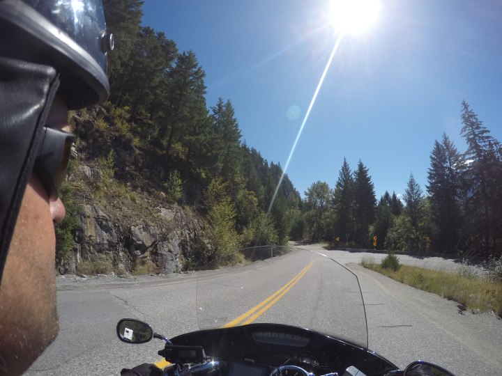
Anyway back to those roads. I’ve never given the road from Cache Creek to Lillooet much love. I’ve stayed in Lillooet twice before so that I could take the Pemberton-Lillooet highway first thing in the morning. This usually meant taking the Cache Creek- Lillooet highway as the last leg of a long day, usually as the sun was setting. Darkness and tiredness are not the best way to enjoy a good motorcycle road- especially one that has the awe-inspiring Fraser Canyon for scenery.
I was able to leave Cache Creek at 8:30- an hour later than I wanted but I decided to visit a car wash, fuel up, and grab a coffee before I left. It was fairly cool out- maybe 15 degrees- and clouds dotted the sky just like last night. I hoped that I wouldn’t be seeing rain.
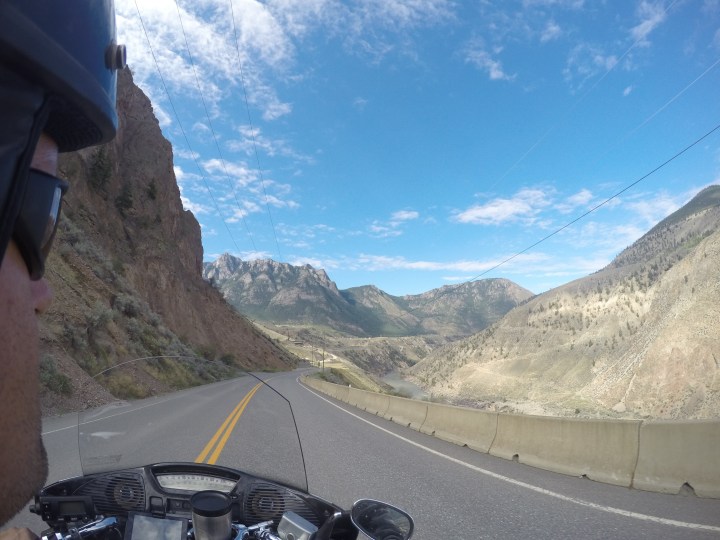
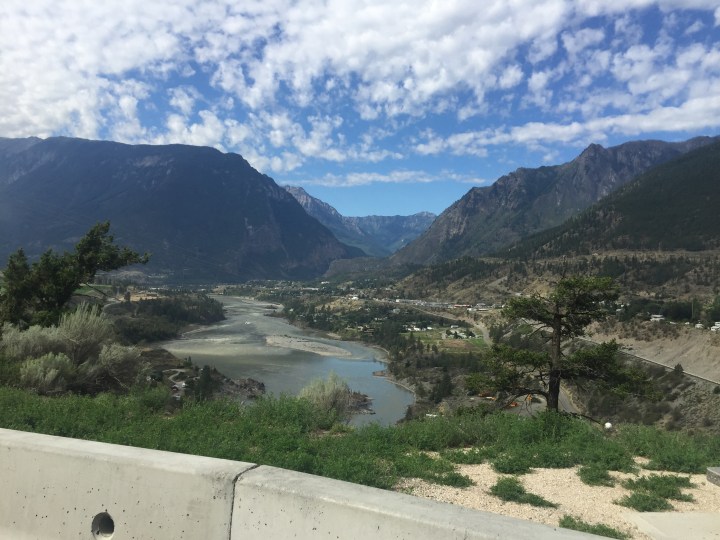
The highway to Lillooet is quite dramatic in the second (western) half. The road sits on a ledge over the Fraser Canyon, and as you near Lillooet the mountain ranges on either side of the Fraser get tighter and tighter. At one point there was some road work happening, but nobody was around. The road itself was down to one lane, was nothing but mud and gravel, and had no guardrails to protect anyone from going over the edge and plunged down the canyon into the Mighty Fraser below. Other than that the ride was pretty uneventful but I’m glad I got to see the canyon views in their full glory before reaching Lillooet.
The main event of this day was definitely the Pemberton-Lillooet Highway. This is in my Top Three Motorcycle Roads along with the Kaslo-New Denver highway and the Creston- Kootenay Bay highway.
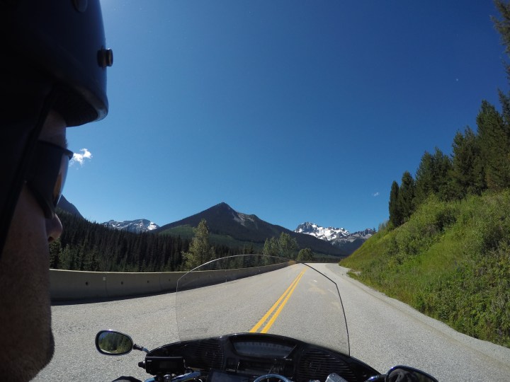
The road takes you from the dry interior of the Thompson Plateau where it meets the Fraser Canyon, over the Glacier- bedded Coast Mountains, and into the Pacific Coastal Region. The road is tight and rugged- very rugged. Many upgrades have been made in the last ten years, especially the upgrading of many single-lane wooden bridges to double lane concrete ones. These were all done in preparation for the Winter Olympics in 2010. They were currently in the process of doing surface upgrades and some widening, and so my big ascent up into the Coast Mountains was slowed by construction delays.

These delays were welcome, as it gave me some time to look around and enjoy the view. This road gets pretty high- not quite tree-line high- but pretty high. They call this highway the Sea to Sky Highway, and this is the Sky part. Glaciers are easily within view and alpine meadows abound. It was Saturday, so all recreation areas were filled with cars as people were out for weekend hikes. I just kept on cruising by and enjoying the ride. The road itself gets pretty twisty and many sections are tight against the side of the mountain. It is definitely ‘don’t look down’ time as there aren’t a lot of guardrails either.
At the end of the ride there’s a crazy long 13 degree descent down into Pemberton. Ever see your life flash before your eyes and nearly crap your pants? In 2008 my rear brakes stopped working on the way down and I had to use a runaway lane. This time I just rode on by, but I always smile when I get to that spot where my foot brake stopped working. That was such a long time ago. With experience comes wisdom. Don’t ride your brakes down steep hills folks- always gear down.
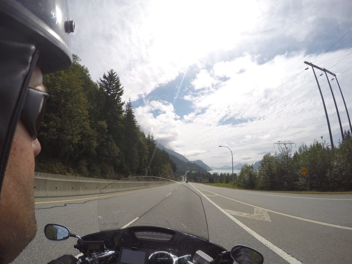
After fueling up in Pemberton I continued down the Sea to Sky Highway to Vancouver. The thing with the Lillooet- Vancouver ride is how progressively busier the highways become. You start out riding glorified goat trails out of Lillooet, and end up on a massive 8-lane highway leading into Vancouver. I’m sure glad I was not going north, as the traffic was almost bumper-to-bumper from Whistler to Squamish. Luckily it was fairly light on the southbound lanes and I made it to Squamish in just over an hour.
The ride from Squamish to Vancouver is a fast highway and it sits high on the side of mountains overlooking the Pacific Ocean. The scenery is fantastic but you don’t get to enjoy it very much because you have to keep your eye on the traffic because it is very thick and very fast. Seeing the ocean is still thrilling for me. It feels like a big accomplishment- I’ve gone as far West as geography will allow. I’ve conquered western Canada.
I arrived in Vancouver after crossing the Ironworkers Bridge and headed east into Burnaby to visit a rock shop I found online. It was exactly what I’ve been looking for. I was able to stock up on supplies and even found a nice chunk of nephrite jade with chromium speckles in it.
After the rock shop I headed into Port Moody to visit more usual suspects on my tours- my friends Scott and Gill and their children. I stayed at their home for a few nights. We drank some good wine, ate some great food, listened to some good music, and played yahtzee for hours and hours. It was great. I only see their children maybe once a year so it’s amazing to see how much they grow in that amount of time. And start talking. And learn to ride bikes.
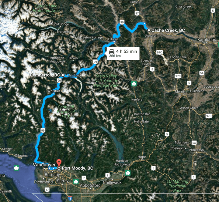
Here’s a map of getting to Port Moody from Cache Creek: