
I ate a lot of fish, drank a lot of beers, and downed a lot of clam chowder. I breathed the salty air in the morning rain, felt the breeze come off the waves as the sun set, and had total solitude and darkness lit only but a little campfire on the beach as the waves crashed against the shore. It was going to be difficult, but it was time to say goodbye to the Pacific Ocean.

I was still able to enjoy another hour of oceanside riding south of Gold Beach. The morning was sunny and the water looked amazing in the full morning sun…up to this point it’s been overcast in the mornings. It looked more blue.
My intention for the day was to get to Bend in the high desert interior, but to get there I wanted to continue south into California…so that I could say that I rode to California, and so that I could ride through their famous redwoods. If you see the map of the day below you’ll see how laughable it is to claim that I rode to California…but a fact is a fact.

After crossing into California and surviving another import screening (I think they were looking for fresh fruit and vegetables??) I headed south and then east into the Redwoods National Park toward Grant’s Pass. I had heard of these famous redwoods…seen pictures of how huge they were…but the National Park was actually a series of different forests…and this particular location did not have huge redwoods. It had redwoods, and many of them…but not those big ones. I was slightly disappointed but stayed firm with the plan. Seeing the big trees would have been another hour and a half south, which would take me past Eureka…from there I’m just a stone’s throw from San Fransisco and that’s only a little bit north from Santa Barbara County, where they shot Sideways. It did occur to me that I could have easily ridden all the way there today. Of course, then I’d only a few hours away from Mexico, and then I start to think I could go all the way down the coast, along the southern states to Florida, up the East Coast, and then into the Maritimes and back across the country to Saskatchewan…and that I could do it in three weeks.
Ok, so that’s what I was thinking about the entire way to Grant’s Pass. The ride was actually pretty great for the first half, after Obrien it got a little boring, but the first half had twists and dips and lots of trees (but they weren’t the big ones). I ended up having some lunch at a Pita Pit and headed south on the Interstate until I reached Gold Hill, where I took Hwy 234 until it met Hwy 62, which took me to Crater Lake National Park. This whole experience really stole the show for the day.
For starters, the ride there was incredible…totally made up for my disappointment about the redwoods. Okay, for the record the redwoods were good but they weren’t those big ones, so it didn’t meet my expectations. Moral of the story here: don’t ever have expectations and you won’t ever be disappointed.
So on the way to Crater Lake you go through some National Forests. The trees get huge and thick and the road gets tight, and so by the time I reached the Park Gate I was already satisfied. I paid my $10 (again…my pass from Mount Rainier National Park was still valid, but they aren’t transferrable between National Parks. They should take a lesson from Parks Canada), and then the craziness started.
Crater Lake is a lake inside a crater, so it is named well. It should actually be called Caldera Lake because it is what remains of a volcano called Mount Mazama. About 8000 years ago some magma chambers around the peak started to spew, and the entire peak of the volcano slid down those chambers and collapsed on itself, essentially plugging those chambers and creating a massive crater in the middle of the volcano where the peak used to be. The volcano didn’t go dormant, and so some lava still flowed out and created new peaks inside the crater. Over time the crater got filled with rain and snow, and so now there exists an equilibrium between evaporation and accumulation (there are no streams in or out of the crater)…the equilibrium is such that a lake can be sustained, albeit with seasonal ebbs and flows in water depth, entirely by the accumulation/evaporation balance. There’s actually many of these around the world but this was the first one I’d seen.
Anyway, that description is accurate but doesn’t capture the beauty of the place. Those new peaks in the crater are now islands in the lake, and the water is a deep blue and is apparently incredibly pure. I hope my pictures do some justice.
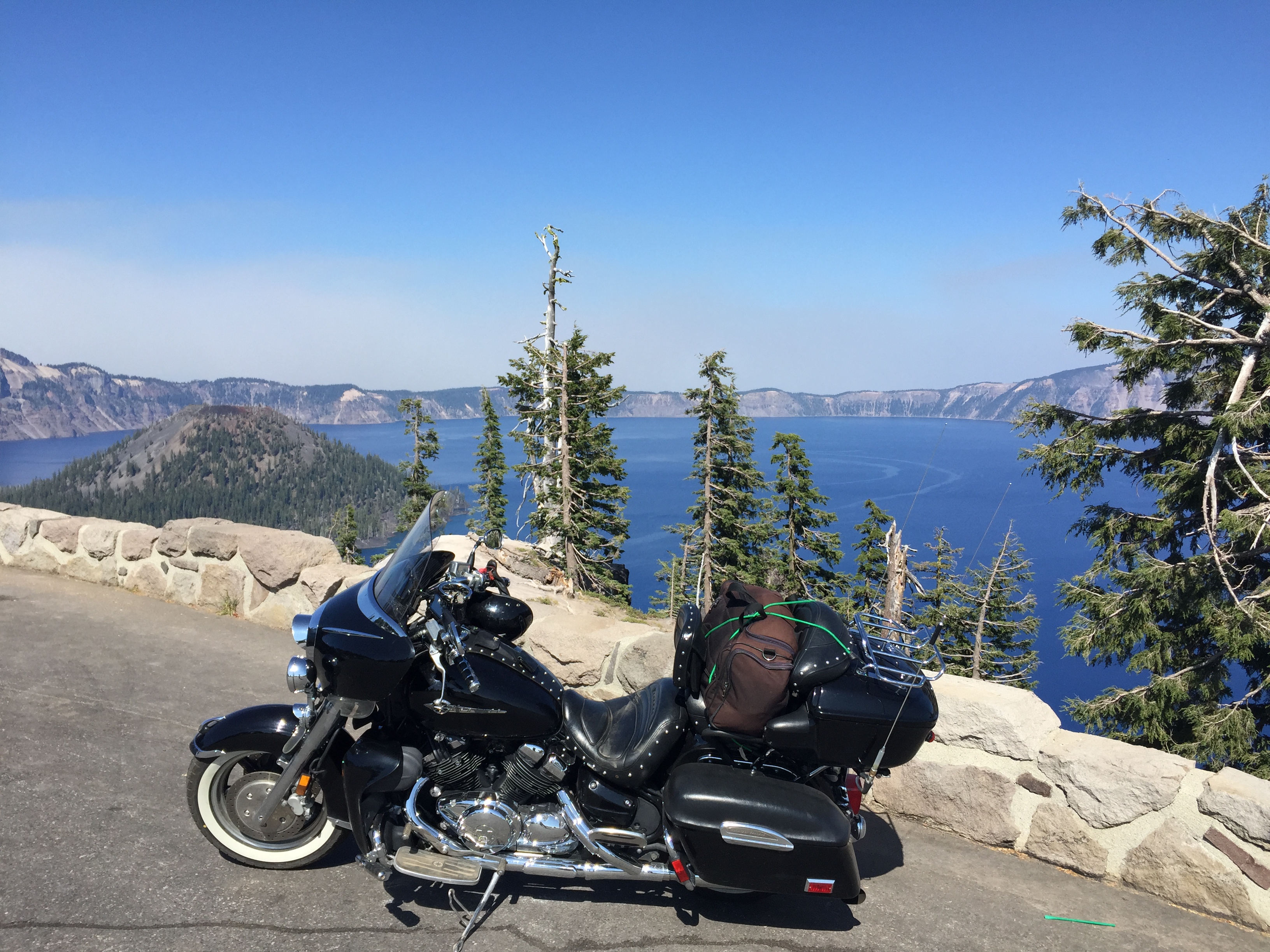
For someone who is into geology, this was like going to Mecca. I was riding my motorcycle on the rim of a volcano filled with water. The entire landscape was filled with igneous rock…dark brown to red and black in colour. When all you’re familiar with is glacial till and an annual trip to see some great faulting in BC, this was pretty far out stuff. Exotic even.
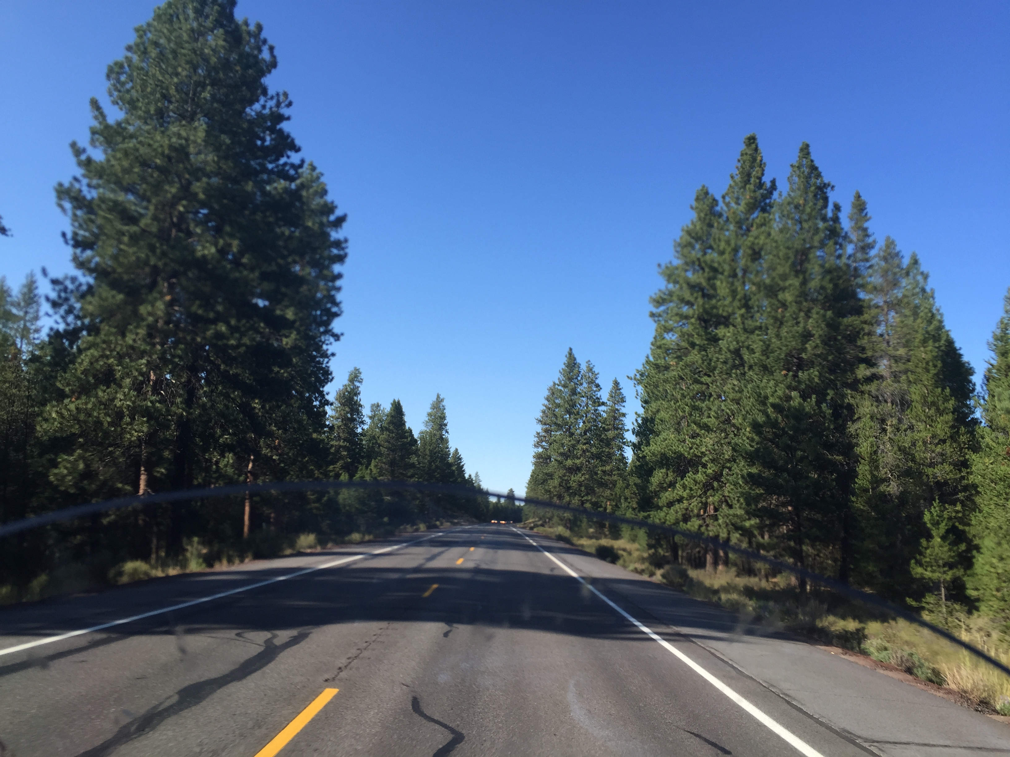
The ride after Crater Lake hooked me up with Highway 97 (same north/south highway that took me from Omak to Chelan in Washington and will take me up the Okanagan in BC later on this tour. The landscape quickly turned from alpine forest to high desert…same landscape you’d see around the Okanagan in BC and the Chelan/Omak area in Washington…but there was a lot more volcanic presence here. You could see the remnants of volcanoes everywhere. Even the rocks on the side of the road were red. This was all volcanic spill. All around me. There was even a lava field on the side of Hwy 97 as I rode in to Bend. If it weren’t for the fact that I was tired and hungry, I’d have stopped to check it out.
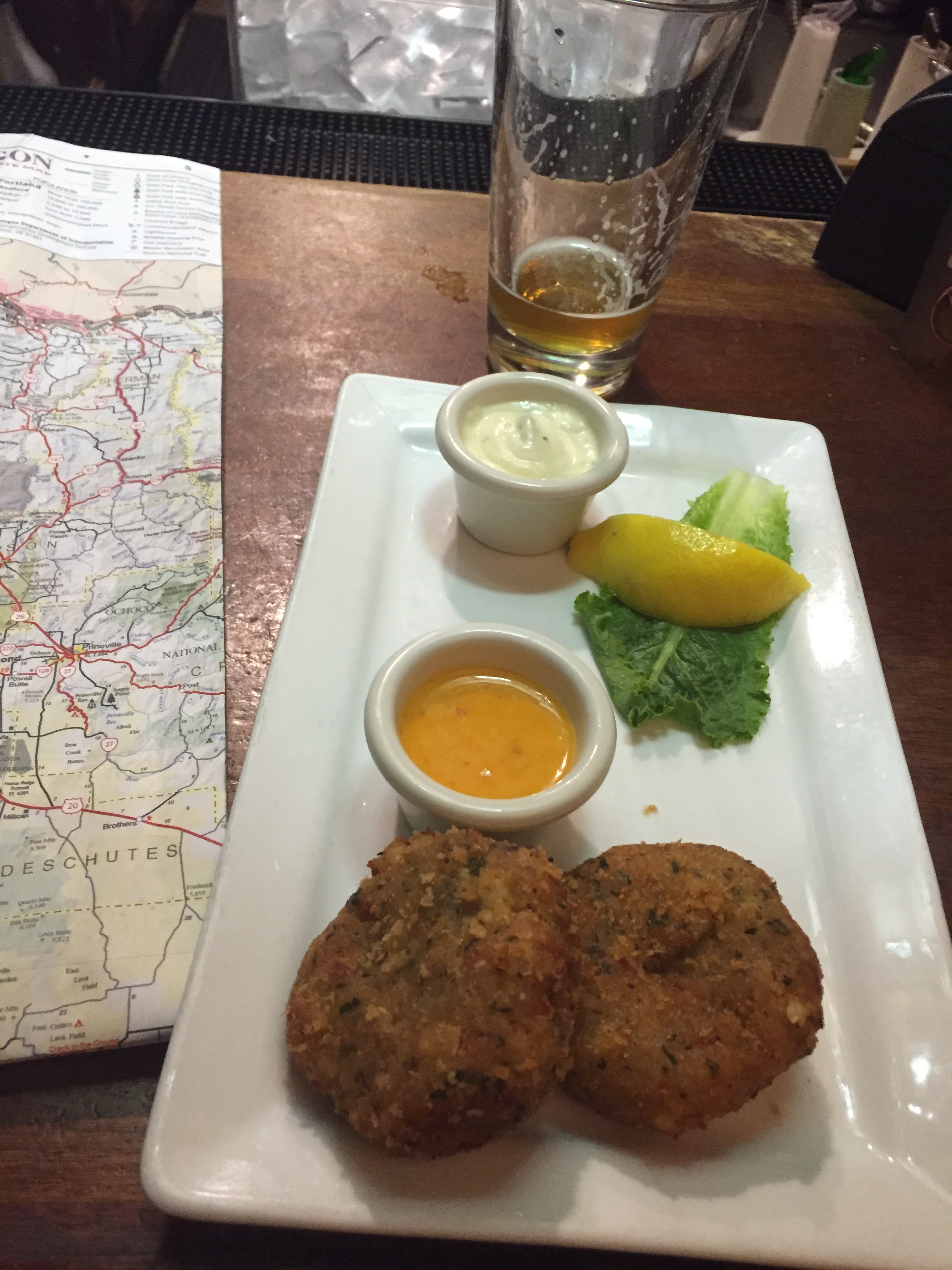
I reached Bend just after 7:00 and went for a dip in the pool. It was pretty warm out but not overwhelmingly hot like on Day 2 en route to Chelan. My motel was great, and was close to a Fish House that had local pints on tap. Bend is known as the capital of the craft beers. I had some crab cakes and calamari and about four local pints before I walked back to my motel and crashed. This was my last night in Oregon. It’s been so awesome. Very, very awesome.
Here’s a video and map of the day:

