Goonies never say die.
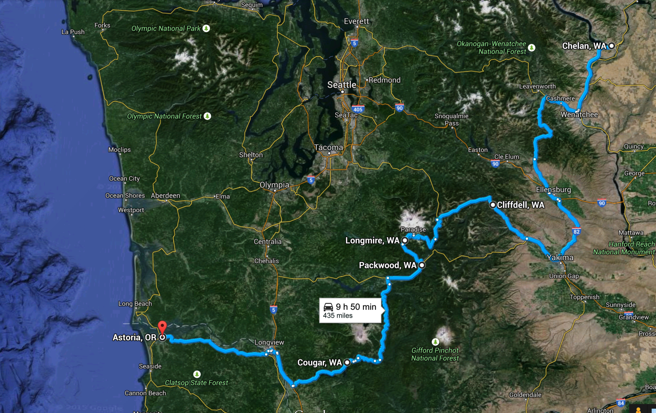
After two long days on the road I was surprisingly up and alert when my alarm went off at 7am. I’m getting pretty good at the early morning starts. I was able to pack Midnight, suit up in my riding gear, fuel up, get breakfast, take some pictures of the lake, and get onto the highway heading south by 8am.

The first part of the day south of Chelan followed the Columbia River until it veered back to the east after an hour or so. The landscape reminded me of the area between Oliver and Keremeos in BC…”mountainy”…but smaller mountains that were covered in dry grasses, sage, and those dark black trees (like they had been burned before). It makes sense too…the entire way south from BC has been on the eastern edge of the Cascade Mountains, and this entire valley was in a rain shadow caused by the mountain range.
The route I took was convoluted again. If I was only interested in getting to Astoria quickly I’d have continued south and found the interstate and rode that…but I wasn’t just interested in Astoria…I was interested in some destination highways. Besides, I’ve always been a wannabe Geologist and was not going to pass up the chance to see Mount Rainer and Mount St. Helens. According to my Destination Highways book, the roads around there are pretty great.
I continued south and actually headed east a bit before being able to head west toward Mount Rainier. There were no roads that offer a direct route from Chelan and so the entire morning was spent riding along the west and then cutting under the south of the Cascade Mountains. Heading west at a town called Naches meant that I would be riding right into that Range, and I wouldn’t be disappointed.
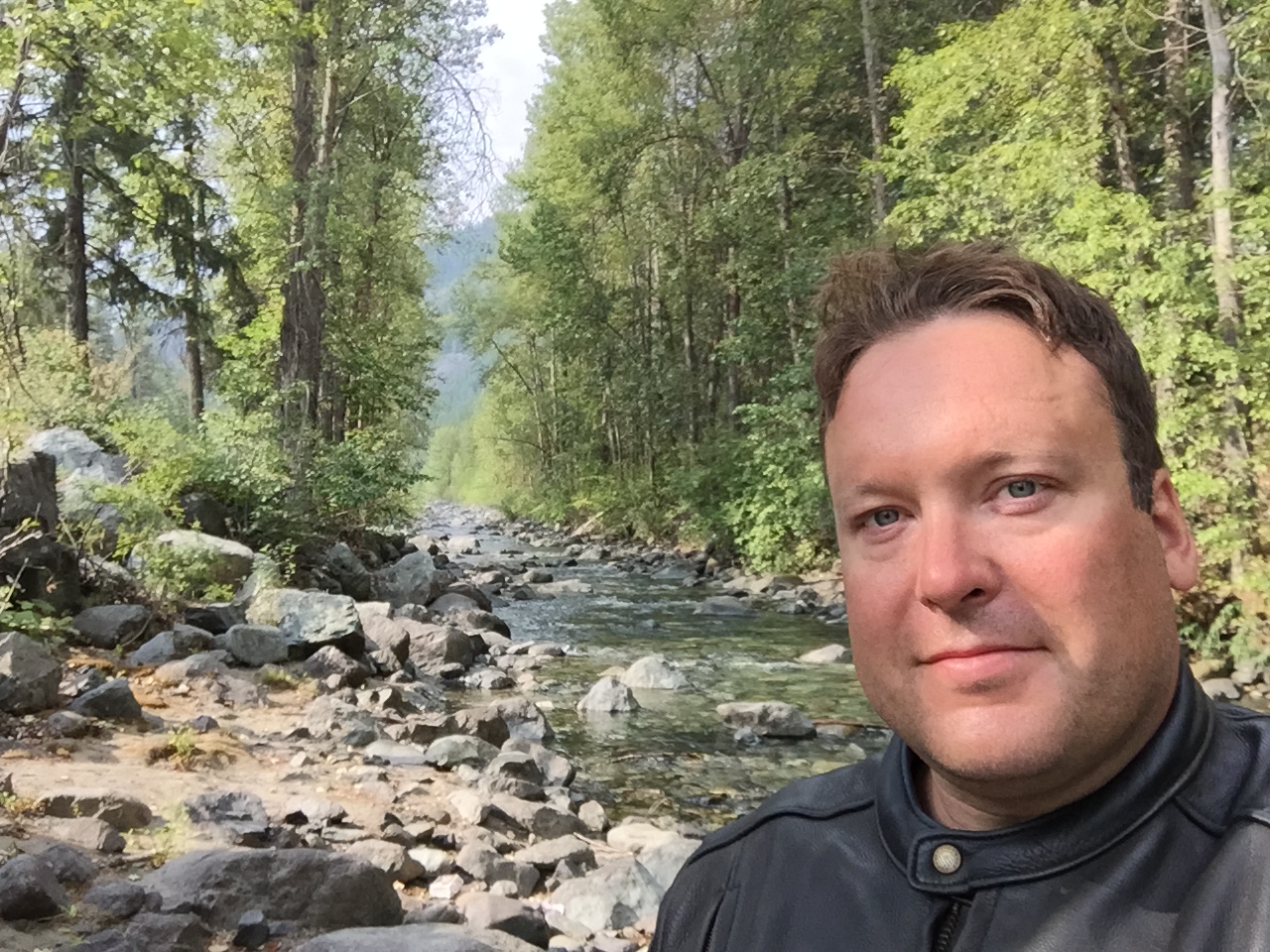
The rigours of three solid days on the road were taking effect on my body. My legs were feeling tight and my butt was getting sore. I was actually amazed that I had gone this long without being sore. Midnight is a comfortable bike, and the sheepskin seat cover my wife bought me a few years ago really helps with the riding comfort. Three days in a row is just a really long time. I chose to have a sit-down lunch at a place called Cliffdell to give myself a break. By this point the arid landscape was gone and I was now in a dense forest on the bottom of the Cascade Mountains.
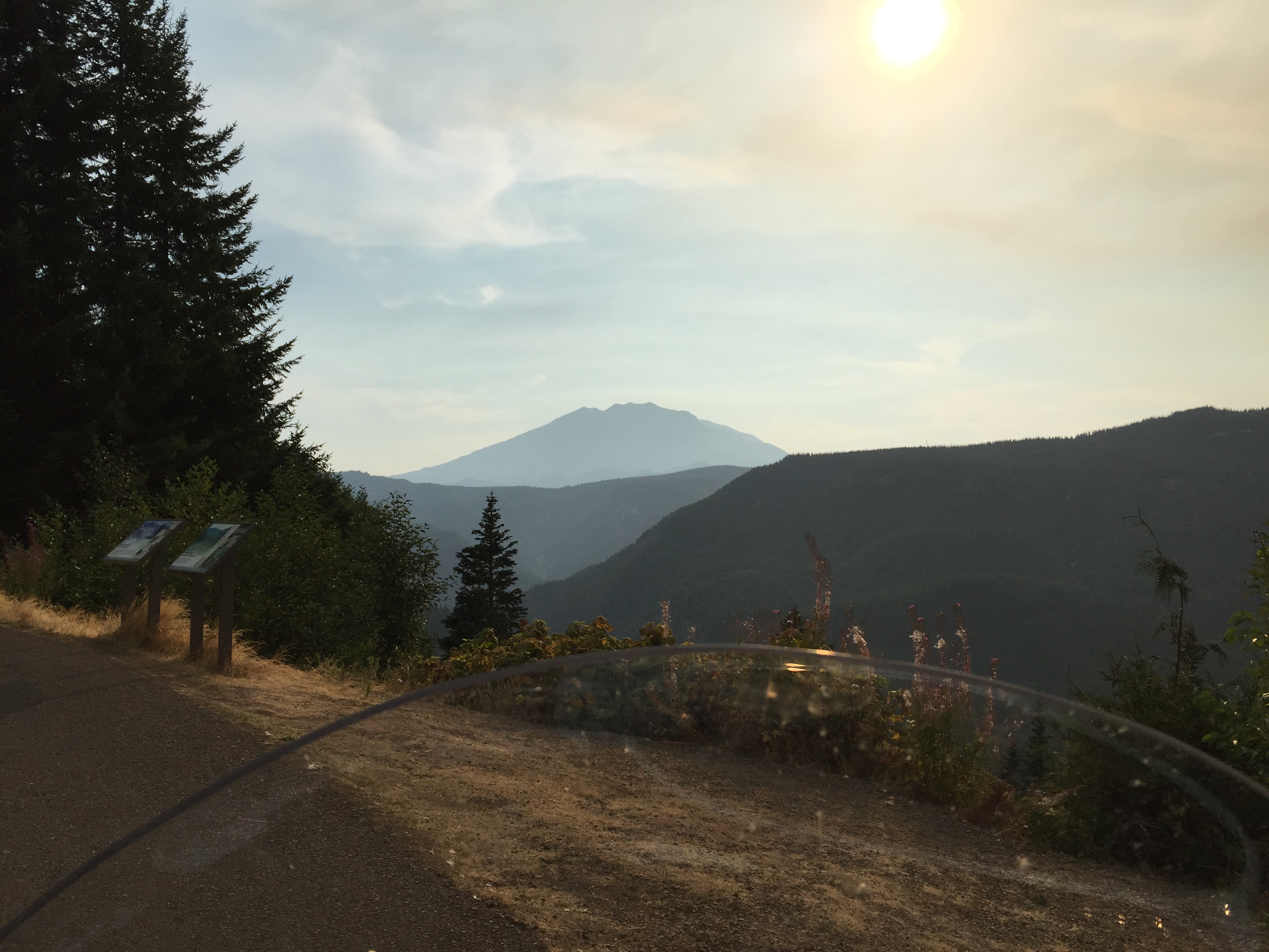
The ride immediately after lunch would end up being the highlight of the day. By 1:30 I was heading further west and I wasn’t sure what to expect…but I was hoping to be able to see Mount Rainer. The highway steadily climbed up the Casades until it reached a pass high up among the mountains. I could see that I was about to ride over the top of the pass, and as soon as I did the trees opened up to reveal a massive mountain towering above the rest. It was covered in glaciers and was so prominent I simply uttered “holy shit” and tried to get as many pictures as I could.

Mount Rainier isn’t a mountain, per se…it’s an active stratovolcano. You can tell by the surrounding rock formations…looked like mostly andesite or basalt but they are definitely igneous instead of the sedimentary rocks you’d find in the Rocky Mountains. If this volcano ever erupts it will be catastrophic. Those glaciers would melt immediately and form lahars– massive rivers of hot water and rock and ash that would wipe out anything in its path.
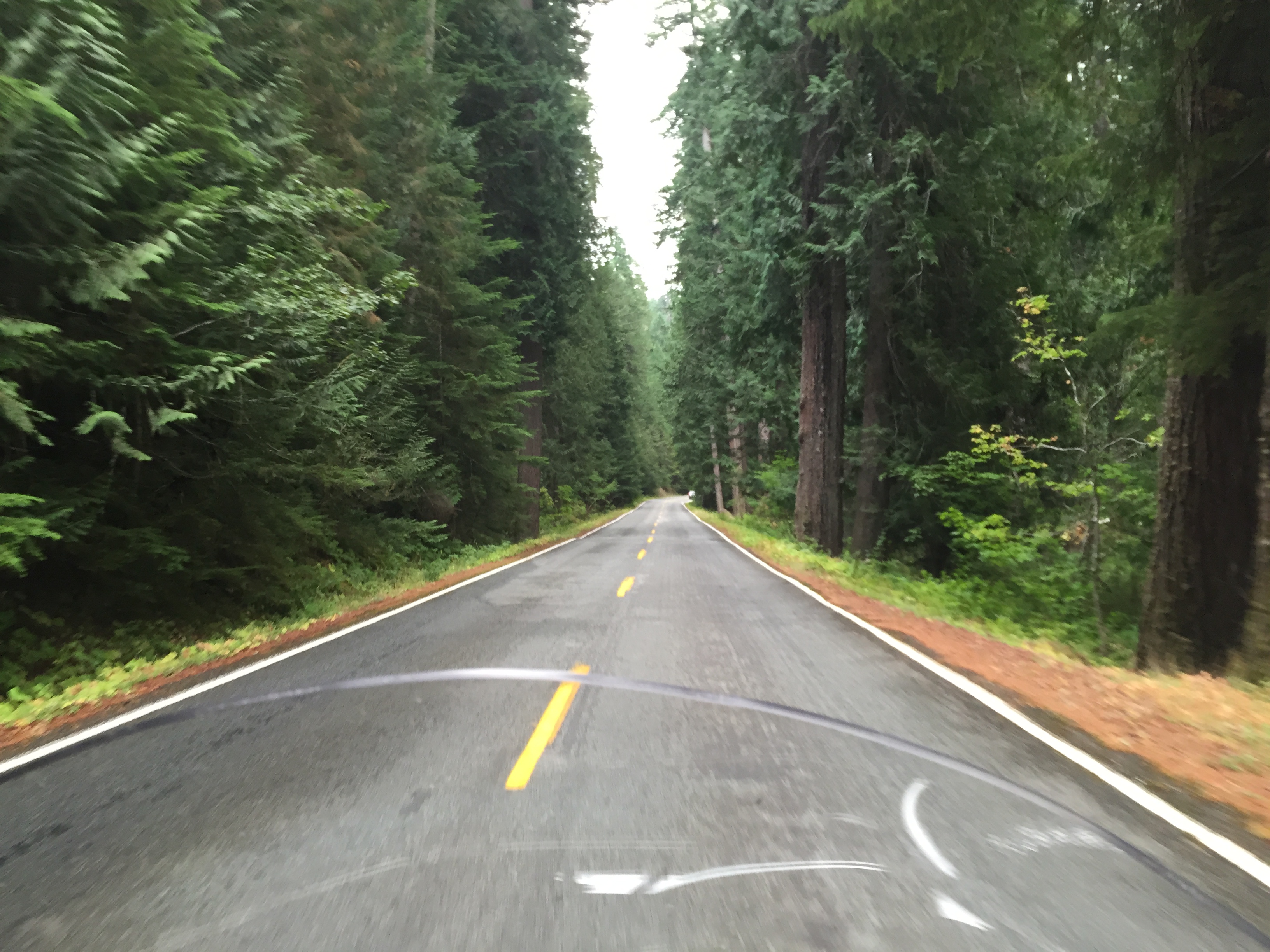
My ride took me around the eastern and southern sides of the volcano through a National Park and National Forests. Cost me $10 to ride through but it was worth it because the road itself was a dream. It was densely forested and twisted and turned and we continued to ascend up over the mountains. We were incredibly high up on the southern leg…the road itself was treacherous with no guardrails. I kept thinking to myself…there’s not supposed to be a road here. I’m not supposed to be here! It reminded me of the Going to the Sun highway in Montana. The Americans keep building roads where there aren’t supposed to be roads.
It was slow going too. I had only travelled about 120km from where I had lunch but it was already after 3:30. At this point I had a moment of weakness. Originally I had planned to cut back through the National Forest toward Packwood, then head west to Randle where I could go south to see Mount St. Helens on the eastern and southern sides…just like I had done with Mount Rainier.
The problem was that I was exhausted and I could have just kept riding west and gotten to Astoria by 7pm. Riding past Mount St. Helens would delay me by two hours and I wasn’t sure I had it in me to stick with the plan. I literally sat at the crossroads thinking of getting in the motel…having a cold pint somewhere…taking it easy…but then I realized that if I didn’t ride past Mount St. Helens I would always regret it. I am so close…the continent’s most famous volcano was less than 100 km away…just power down and push on through, I thought.
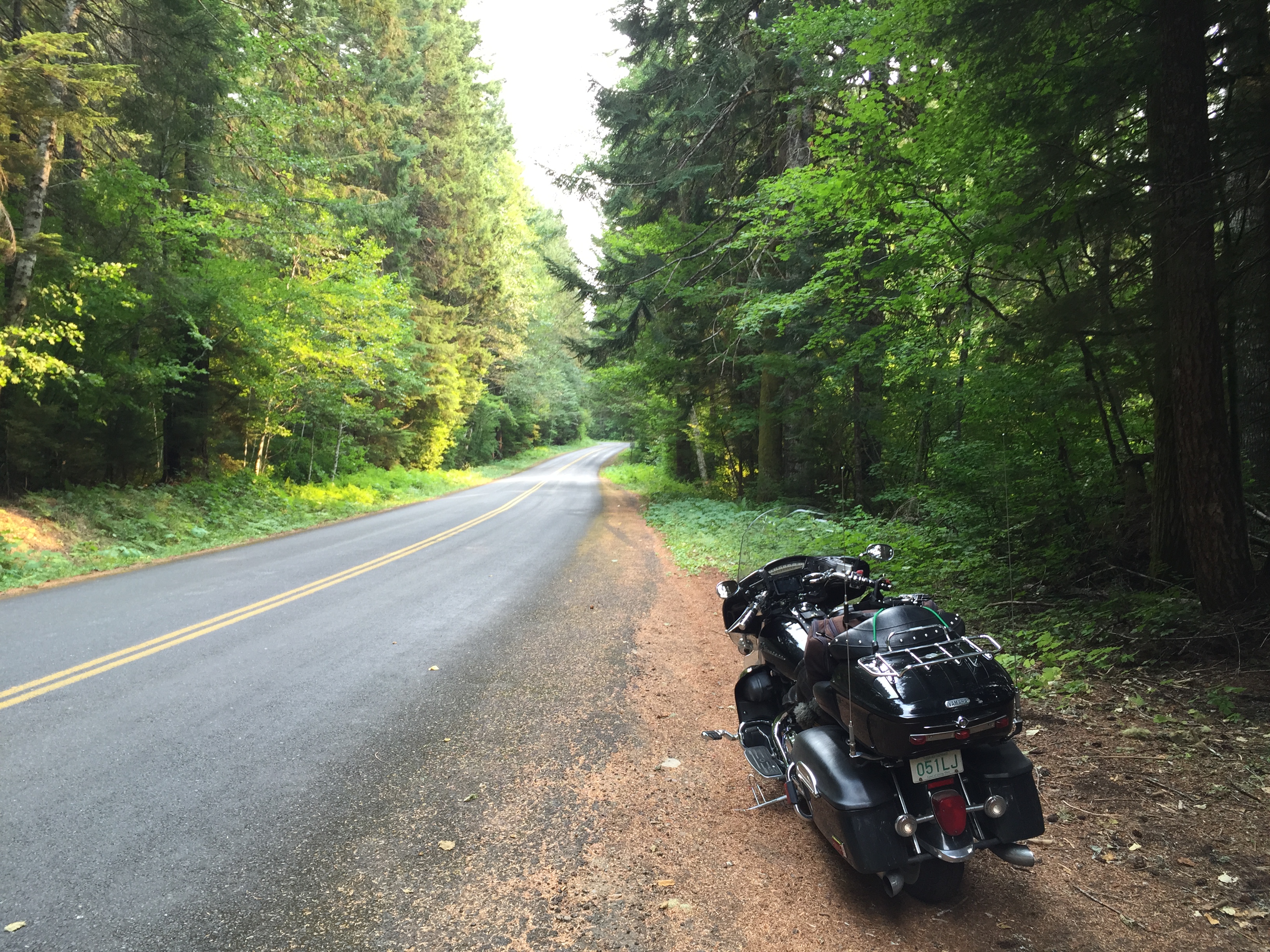
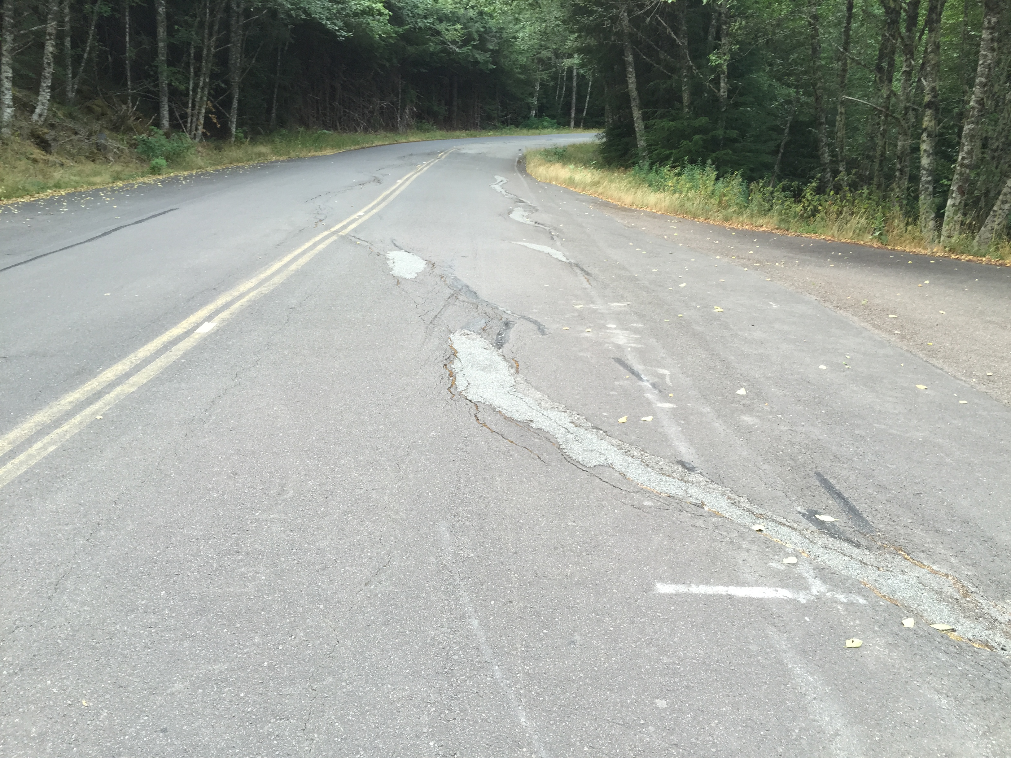
The ride back through the National Forest was awful. They call them “county roads”…but what it means is that the road is weathered and battered and full of heaves and pits and slopes. I nearly wiped out hitting some of them. The forest was beautiful…just like to the east of Mount Rainier, but the pavement quality ruined the experience. Oh well, it only lasted 30km. After refuelling at Packwood I headed west to Randle for another “should I ride Mount St. Helens” debate. The volcano won. It was already 4:30pm.
For the next three hours I would regret riding south past Mount St. Helens. The forest was thick and lush, so that was good…but the road quality was even worse than the ride to Packwood and was downright dangerous. Add a high ascent up the mountains and no guardrails, and you have a recipe for disaster. Fortunately the twists and turns prevented me from going faster than 50km/hour so I was able to weather most of the road problems. I was willing to deal with the shitty road conditions if it meant seeing Mount St. Helens…but the road gave ONE view of the volcano. One. The forest was too thick to see anything for the rest of the ride. Three hours it took to get through the road, and by 7:30 I was past the southern side and met up with the Interstate. It was only about 120 km and I tried not to stop, but my legs and ass were getting too sore. They had gone from discomfort to pain.
The Interstate was a serious wake-up call after the slow, tight, crumbling mountain roads. The traffic was heavy and it was fast. Fortunately I only had to ride it for about 30km until I got off at Longview and crossed the Columbia River for the last time. The last time…it was crazy to think about. I had been following and crossing that river the entire trip since passing Columbia Lake south of Radium…and now I was going to follow it to where it flows into the Pacific Ocean.
I was now in Oregon after crossing the bridge over the Columbia. There was another 70km to go, and the sun was setting. The road was pretty fast but I wasn’t able to beat the sun. By the time I reached Astoria it was dark out and so I missed out on the dramatic entrance. I love entering a town for the first time…check out the first impressions….hoping to steal some ideas for our entrances back home.
By the time I checked in, unpacked, and showered it was 9:30. I made my way to Astoria’s Riverwalk one block away, and strolled up it to a place called the Buoy Beer Company. I had researched this online before coming, and they had exactly what I needed: some great craft beer and solid food. Astoria, and all of Oregon for that matter, is known for having good craft beers. I was going to enjoy as many of them as I could while I was here.

I treated myself to one of the house specialities- fried oysters with a jalapeño jelly and goat cheese. The restaurant is over the water, and on the floor they have a window so you can see down into the river and a little wooden dock they have underneath. During dinner I was seated near the open window area, and could hear some kind of barking. As I was leaving I could see what it was…on that little dock was a sea lion! I tried to get a pic but it took off before I could get the iPhone out. I went off with my server about how cool it was and she was all like “meh, yeah it’s neat.” I guess she’d be used to them…but not like she’s used to some pest animal like I would a gopher…more like a Canada Goose…very cool to see but commonplace enough not to get thrown into a fit if you see one.
I strolled the riverwalk and could hear a lot more barking. The sea lions were active out there. It was too dark to see them, but I could see the lights of the massive container ships sitting on the Columbia. I just sat there in the dark and breathed in the cool, moist air and enjoyed the breeze.
I had made it…Astoria in three days. I texted home and my wife said everything was great there. My travel plans were going like clockwork, and all was right with my world. The Goonie Tour 2015 was an incredible success so far.
And that makes me the richest man in Astoria.
Here’s a video and map of the day: