Saturday, July 12, 2014
Today was a riding day with a single purpose: cross the Rockies and head south into the Okanagan…taking the exact same route I took on my first tour back in 2006.
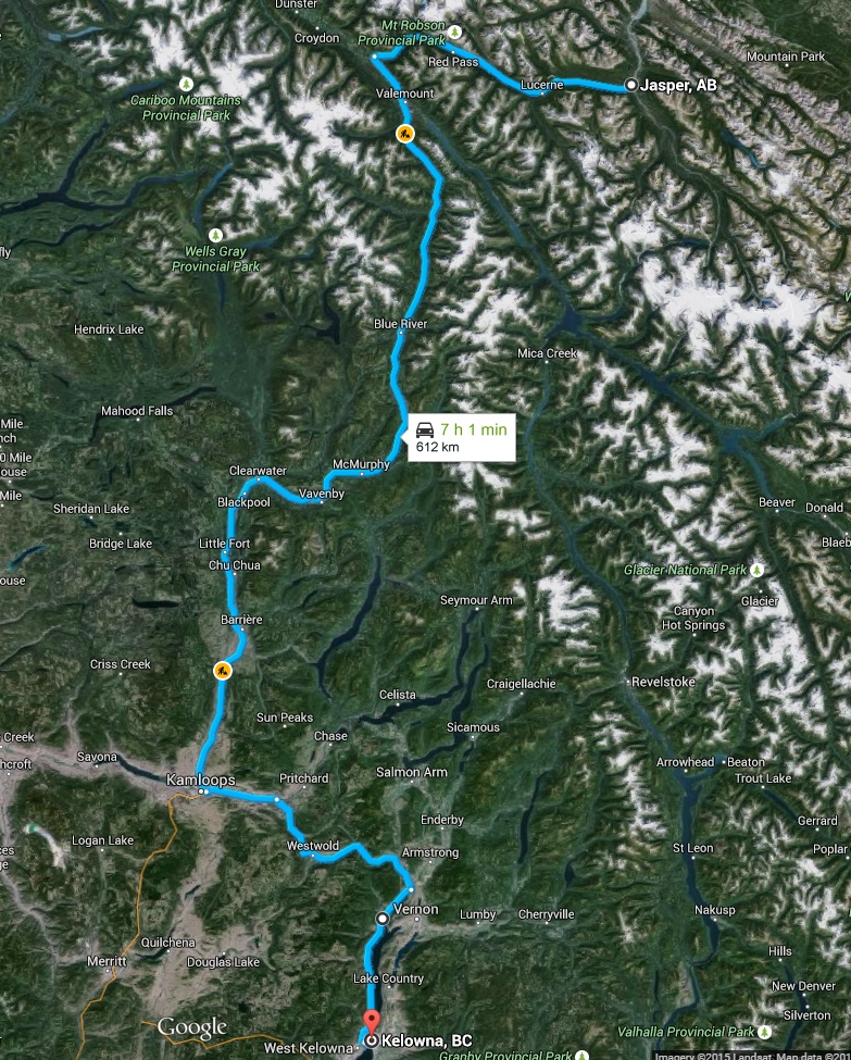
I bade a quick goodbye to my siblings around 7am, packed my things onto Silver, fueled up, and was back on the Yellowhead at 7:30. Despite the heat yesterday, the mountain air was chilly and the refreshing smell of the forest was everywhere. There were still no clouds in the sky and traffic was light. The first few hours of riding were incredibly enjoyable.
I thought a lot about that first trip in 2006 on today’s journey. I recall back then having a flip phone and how cool I thought it was…if I knew then what my iPhone could do today I’d have been amazed. GPS units weren’t mainstream back then so I relied more heavily on maps than I do now because of my Garmin. Silver is the same, albeit with a few modifications…and one thing that has not changed over these past 9 trips has been the way I pack. I not only pack the same way using the same techniques and bungee cords…but I use the exact same bags…each of them faded on the top from 9 years of touring under the hot sun into BC and back.
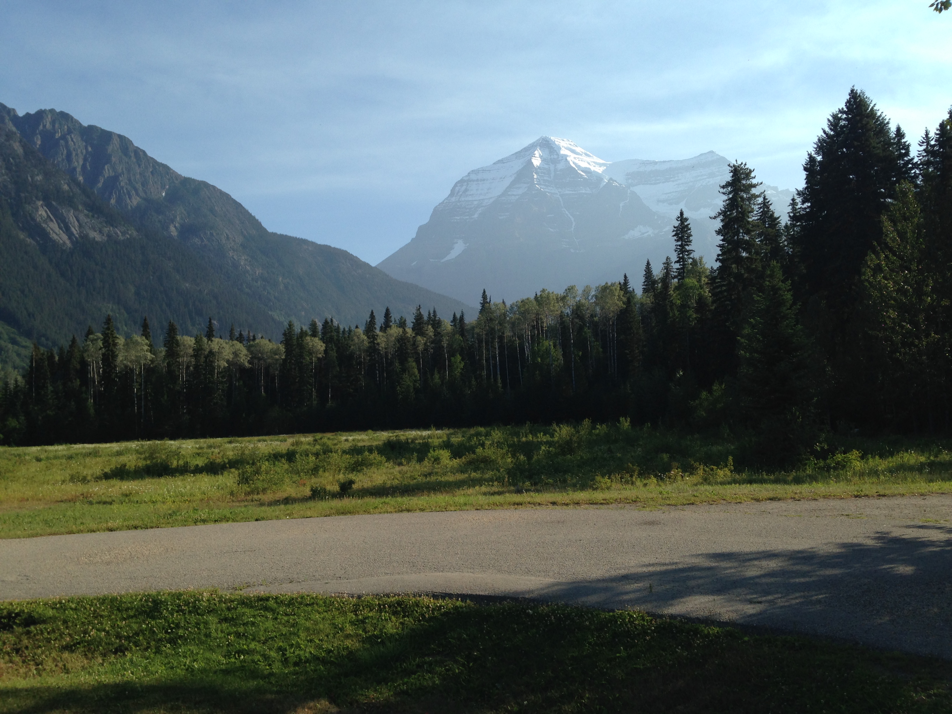
After getting through the Rockies, the Yellowhead splits in two, the south arm becoming the #5 which follows the North Thompson River as it meanders through the north end of the Monashee Mountains and into the Thompson Plateau at Kamloops. The highway itself is straight and fast for mountain roads, most of it being posted at a 100km/hour limit. It’s a good route for getting into the BC interior…you can make some serious distance in a relatively short amount of time.
After nearly five hours of riding I stopped at a town called Little Fort for some lunch and a short break. I had to change my gear at this point too- it was about 30 degrees out and my heavy riding jacket was too much to bear in the heat. The Thompson Plateau, which begins just south of Little Fort and north of Kamloops, is very different from the Rockies and Monashees I had just ridden through. It is drier, hotter, and more closely resembles the desert that the lush Rockies and Kootenays.
The real story about the ride over the plateau through Kamloops and east toward Vernon was the heat. It was 37 degrees. We had a cool spring at home and I was not used to high temperatures. The many hours of riding combined with the heat were causing fatigue, and for that reason I opted not to ride through Vernon and fight with the heavy weekend traffic on the 97 to Kelowna. Instead, I took the Westside Road down to West Kelowna.
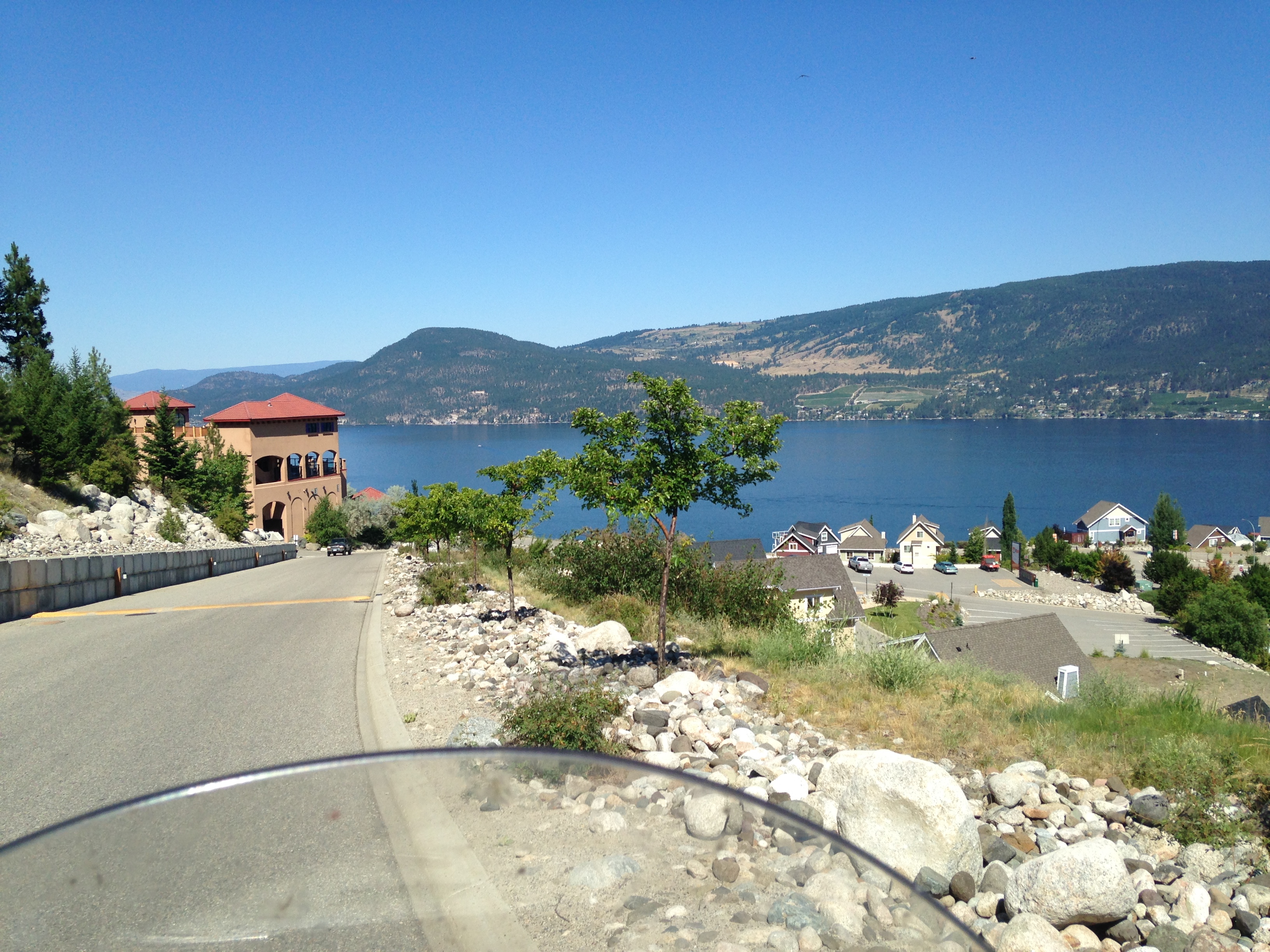
The road is one of the better motorcycle roads in the Okanagan, and served as some nice foreplay into some serious riding. It is only two lanes, and it hugs the hillside above Lake Okanagan for 60 kilometres with no guardrails. You have to pay attention to the curves, but the lighter traffic was a more safe option that the 97 would have been. Halfway down the lake on the Westside Road is the La Casa resort community, where two years prior on the Road Warrior Tour 2012 my cousin Lara got married. I stopped there to take in some water.
I finally reached my hotel in Kelowna at 4:20 local time (I gained an hour after crossing the Continental Divide west of Jasper), and after checking in I had a long shower to get the dirt and sweat and stink from the road off of me. Back in 2006 I ate and had several pints at the place called the Pheasant and Quail on my first night in Kelowna…but that pub has been replaced by a Tap House. I ate there for old time’s sake, drank a single pint of this crazy tangerine white ale, and took a walk down to Gyro Beach. Once I was back at the hotel I crashed pretty hard…I had been on the road for 8 hours.