Monday, July 29, 2013
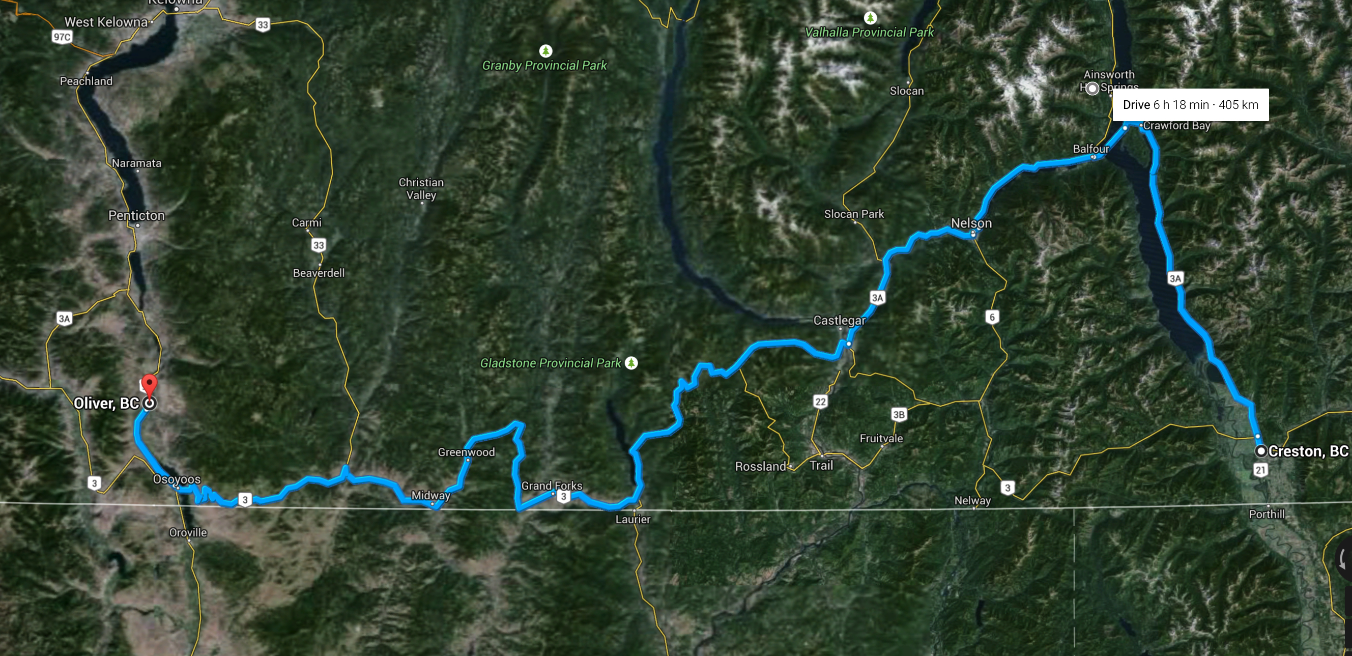
If I knew I only had a few more hours to live, I’d want to spend those hours riding Silver on the road from Creston to Kootenay Bay. It is the perfect riding road in almost every way. It winds up the eastern shores of Kootenay Lake giving you beautiful lake vistas to the west. Straightaways are nearly nonexistent as the road esses and curves along the lake on side and the Purcell Mountains on the other. The engineering is fantastic and so is the road quality. For people who enjoy a good ride, this is as good as it gets.
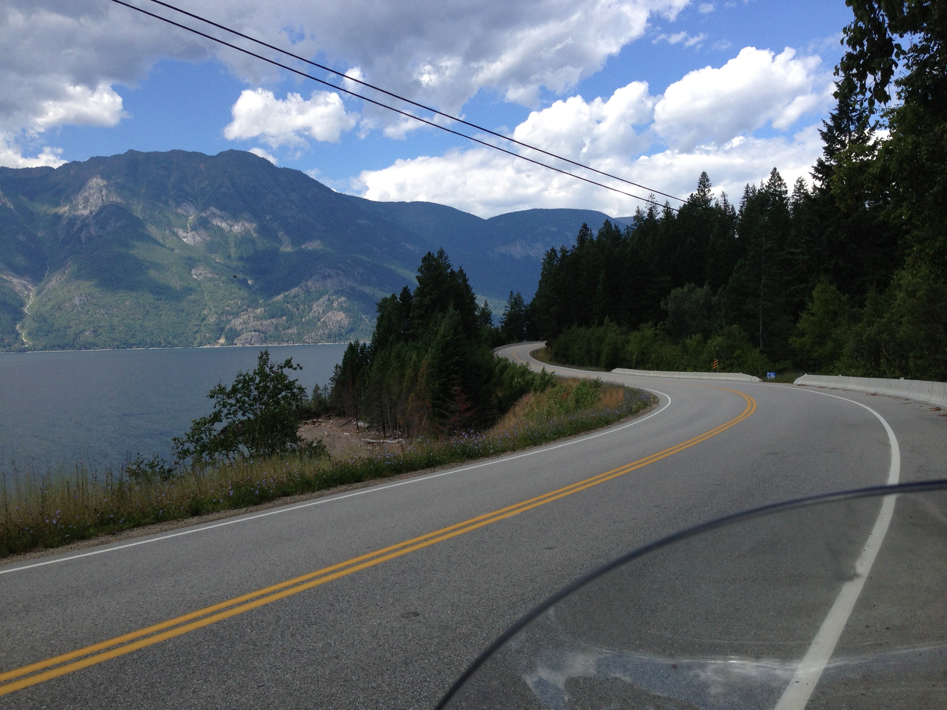
The best part is that afterward you get to ride a ferry across Kootenay Lake and enjoy more stunning lake and mountain views.
The lake sits in between the Purcells to the east and the Selkirk Mountains to the west…it is long, deep,and beautiful. My only complaint was that there were rain clouds in the sky.
By the time I got across the lake it was nearly 3pm. I had a late start because of rain in Creston, and I waited for it to clear up before leaving at around 11.
I’ve always enjoyed riding the Crowsnest Highway from the Kootenays to the Okanagan. The highway itself is a remnant of the Dewdney Trail, a trail built by Edgar Dewdney (yes…the street in Regina is named after him) whose only reason for existence was to have a route from the mineral rich Kootenay and Boundary regions to the west coast of Canada. During the mining booms in those areas many of the minerals went south into the United States and there was a fear of losing autonomy in the southern interior of British Columbia to the Americans. The result was a trail that was somewhat forced…sometimes does not follow natural valleys or passes…but it is also the most direct route to go east to west in southern BC.
Now that I had crossed Kootenay Lake I was now in the middle of the Selkirk Mountains. I headed west along the west arm of the lake to Nelson, where I fuelled up and continued west toward Castlegar. Along the way I passed an intersection with a highway that went north up to the Slocan Valley…and a few days ago 35,000 litres of jet fuel emptied into the river there. I was curious but decided just to avoid the whole scene. No good can come from that.
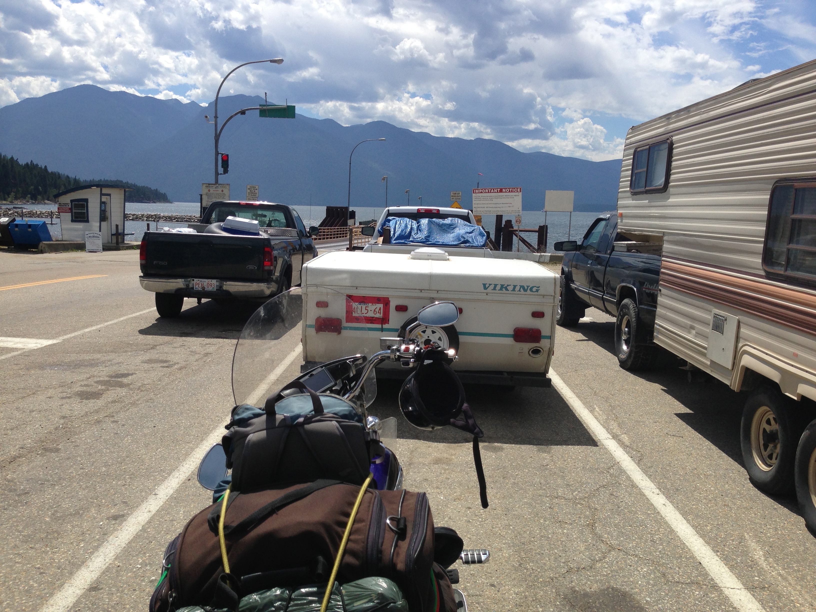
Castlegar sits on a bit of a transition zone between the Selkirk Mountains and the Monashees, and when you head west out of Castelgar you ascend, and ascend, and continue going up over the Monashees until you reach Bonanza Pass after nearly an hour. The Pass itself is quite high…5036 feet…it is heavily forested, and after reaching the pass you start to descend into the Christina Lake region which also signals the end of the Monashees and the beginning of the Okanagan Highland. There’s actually a very cool bridge called the Paulsen Bridge right after the pass, and it bridges the sides of two ranges and sits high above a steep valley.

So after Christina Lake we rode throughwhat is called Boundary Country…called that because it hugs the American border pretty tight. A few times on the road we were less than a kilometre from the border itself. The area transitions the lush, green, towering Kootenay area with the brown, dry Okanagan. The landscape is rolling brown hills and is dotted with large trees that look like they desperately need some water. You can smell hot, dry wood everywhere andthe whole area feels like a giant tinder box.
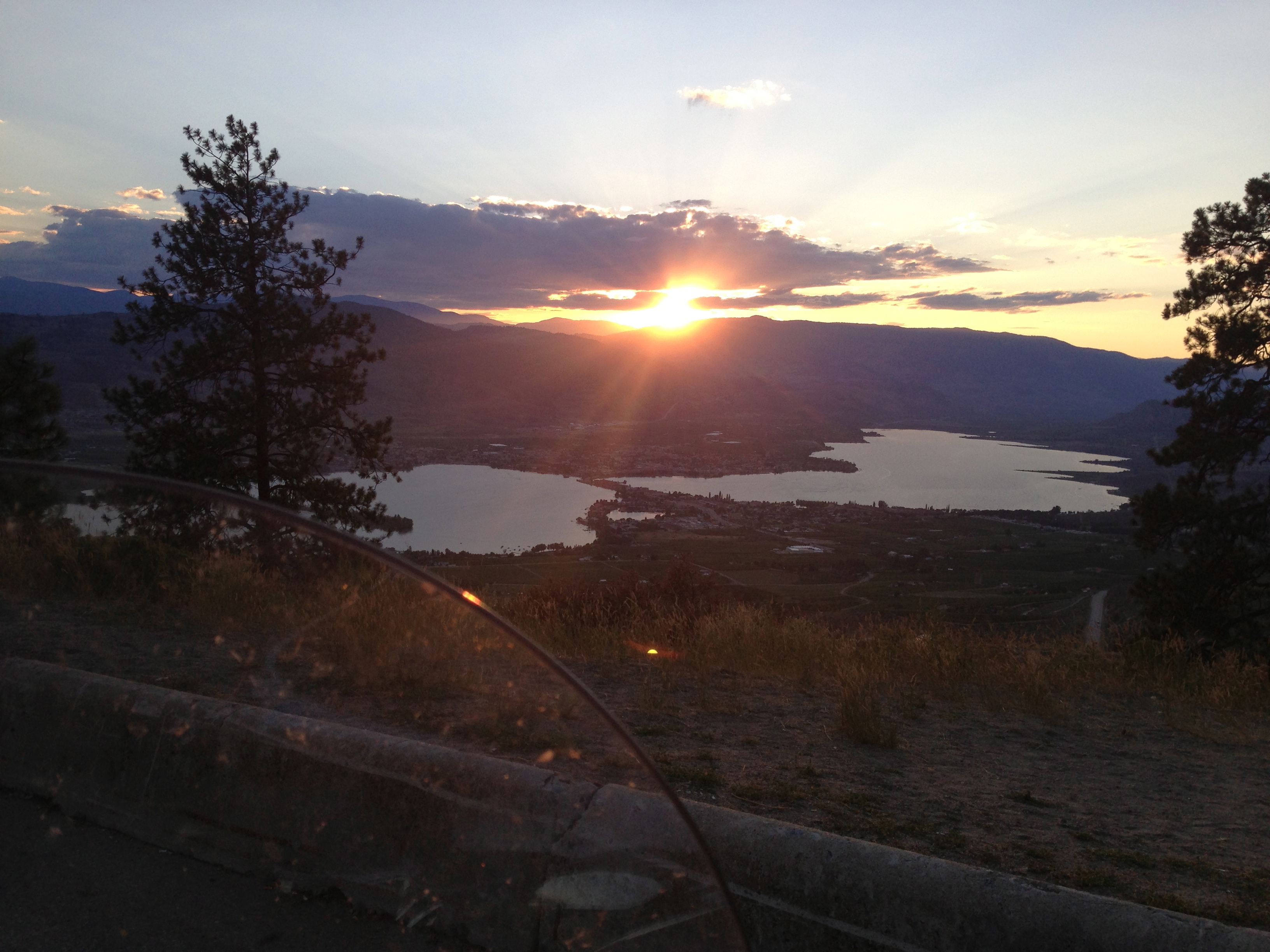
The sun was starting to set by the time I reached the Okanagan…and the entrance into the valley is stunning. The longest continual ascent on any highway in Canada is on the Crowsnest to the east of Osoyoos…and since we were going west we got to look down into the valley from the road. I’m sure you’ve seen pictures from this road…check out nearly every single bike tour album of mine…the famous vista on this road overlooking Osoyoos is one of those “postcard photos” everyone takes.
We reached Oliver at around 8:30 and checked into our motel. I stayed at the Maple Leaf Inn…this was my first time here after staying across the street at the Cactus Tree Inn on several previous tours. On the Road Warrior Tour 2012 I became disenchanted with the Cactus Tree because the beds aren’t as comfortable. The Maple Leaf beds were much better…but they don’t have a pool. If I was at the Cactus Tree I probably would have gone for a dip.
The motel is right next door to Savvios restaurant. I’ve had trouble here in the past with shitty service and food quality, but decided to give it another try. I was pleasantly surprised. The calamari I had was stellar and the service was top notch. Next time I’m back in Oliver I’ll go again.
I walked around the town for a bit before heading to bed. The air was hot and dry…classic Okanagan weather…and while I was glad to be back here I knew that leaving tomorrow would be difficult. I usually hang out here for at least a few days. Not this time…there are no Tall Towers here.